Have a Look at Vancouver in the "Good Old Times" from the City's Archives
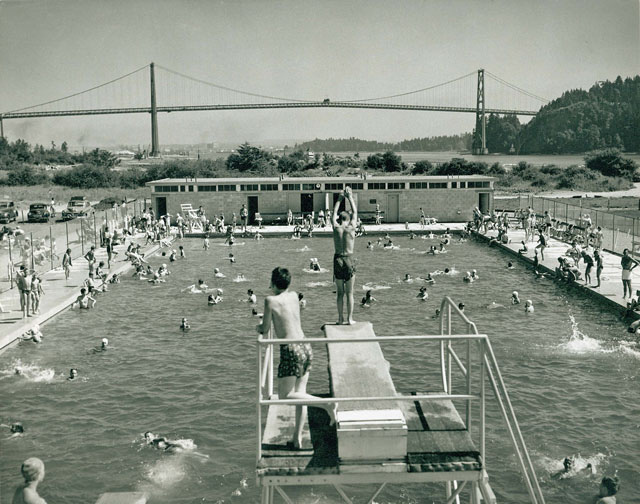 Ambleside Pool
Have you ever wondered how your city looked like twenty, thirty, or even more than a hundred years ago? Vancouver, the country’s third most populous city, developed from the original settlement of Granville, growing around the Hastings Mill sawmill in the 1860s. Vancouver was later connected to the transcontinental railway in 1887 and through its perfect seaport nature became an important link with Asia, Eastern Canada, and Europe. Forestry has always been one of its largest industries.
Let’s travel back in time and look at some of these beautiful historic photographs documenting important events, daily life, and the changing of the face of the city. Do you recognize some of the places? You might be surprised how they looked decades ago and mesmerized by the look of the people who once walked the streets of Vancouver.
These photographs are digital reproductions of public records from the West Vancouver Archives, which document the lives and experiences of residents, businesses, and community organizations in West Vancouver’s past. If you’d like to explore the history and discover even more exciting photos, you can browse their digital collection online.
 Cordova Street (1890) - Looking East from Cambie
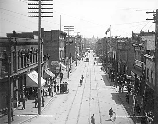 Cordova Street (1890) - Looking East from Cambie
Chinese Community Arch celebrates the visit of Their Royal Highnesses the Duke
and Duchess of Cornwall and York (1901)
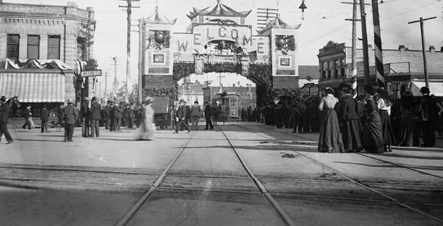 Chinese Community Arch celebrates the visit of Their Royal Highnesses the Duke
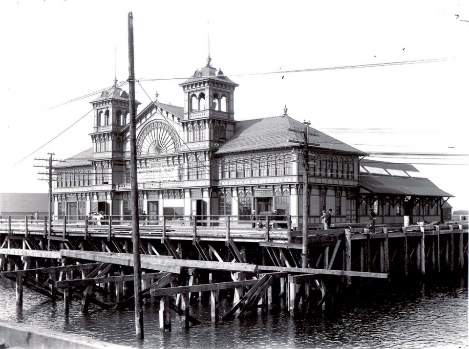
A photograph of the Ferry Building on 14th Street with shops and the
pier (1913)
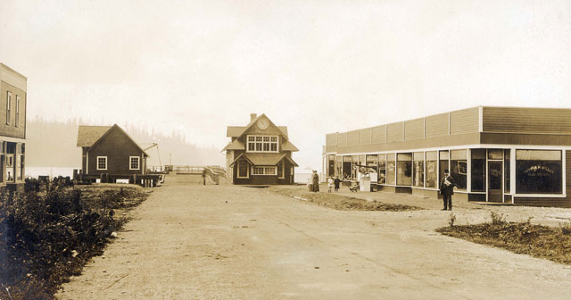 A photograph of the Ferry Building on 14th Street with shops and the
Sonrisa Ferry with passengers near Horseshoe Bay
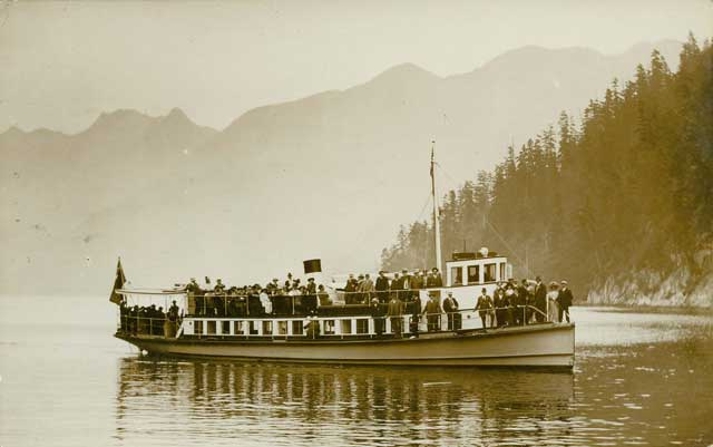 Sonrisa Ferry with passengers near Horseshoe Bay
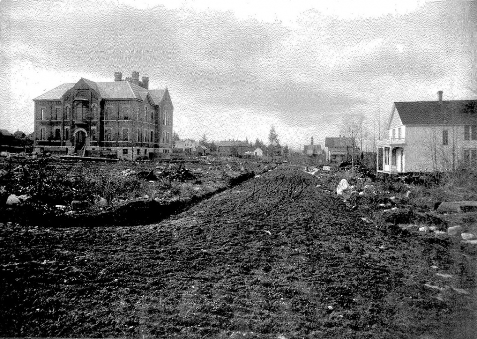
Mount Pleasant School (1893) - This street now paved, concrete sidewalks, double track street car lines.
The precise spot in which this photo was taken was the present lawn of St. Michael's Church.
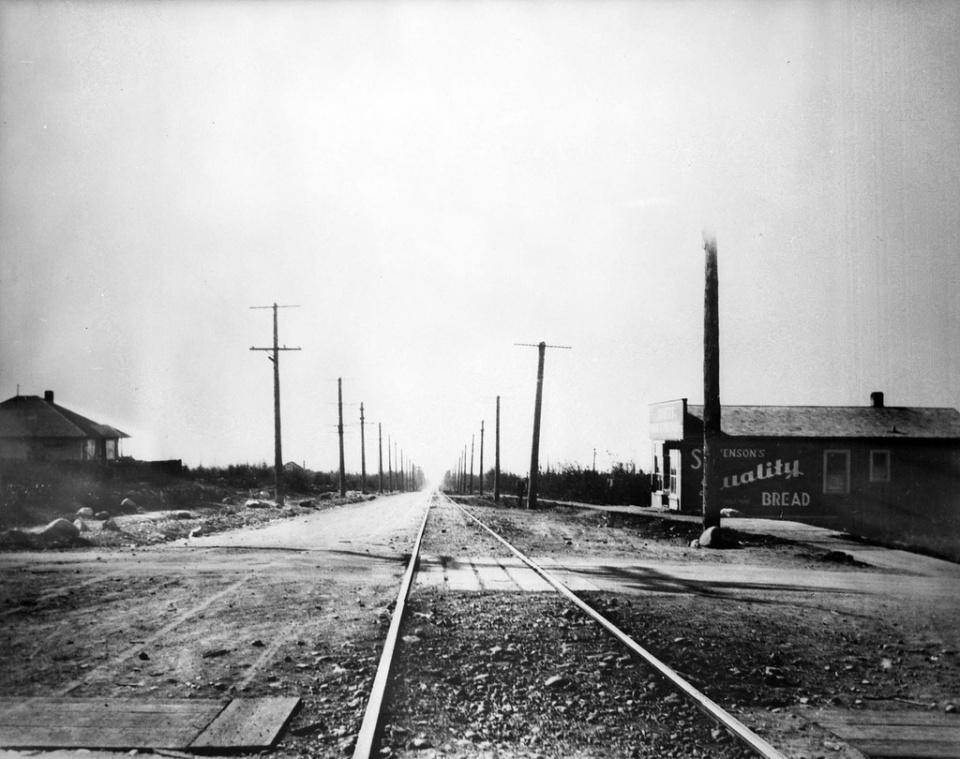
Streetcar tracks Dunbar (1930's)
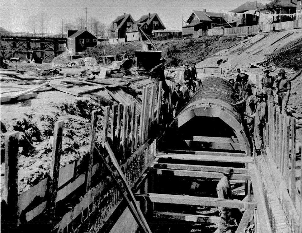
Men working on sewage in Mount Pleasant (1913)
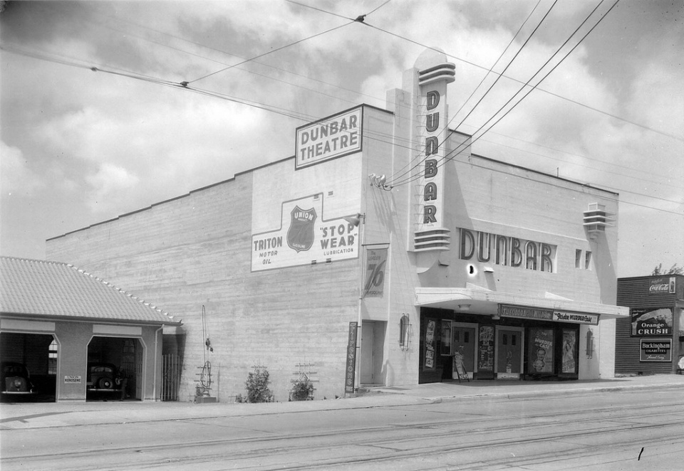
The Dunbar Theatre (1937)
Marine Drive in the snow, looking east from 16th Street.
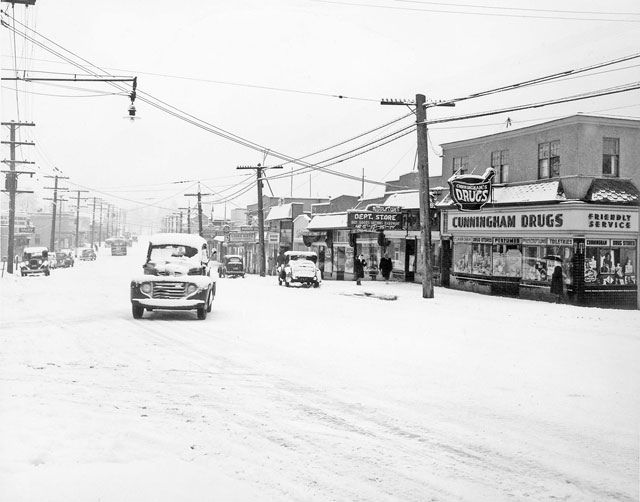 Marine Drive in the snow, looking east from 16th Street.
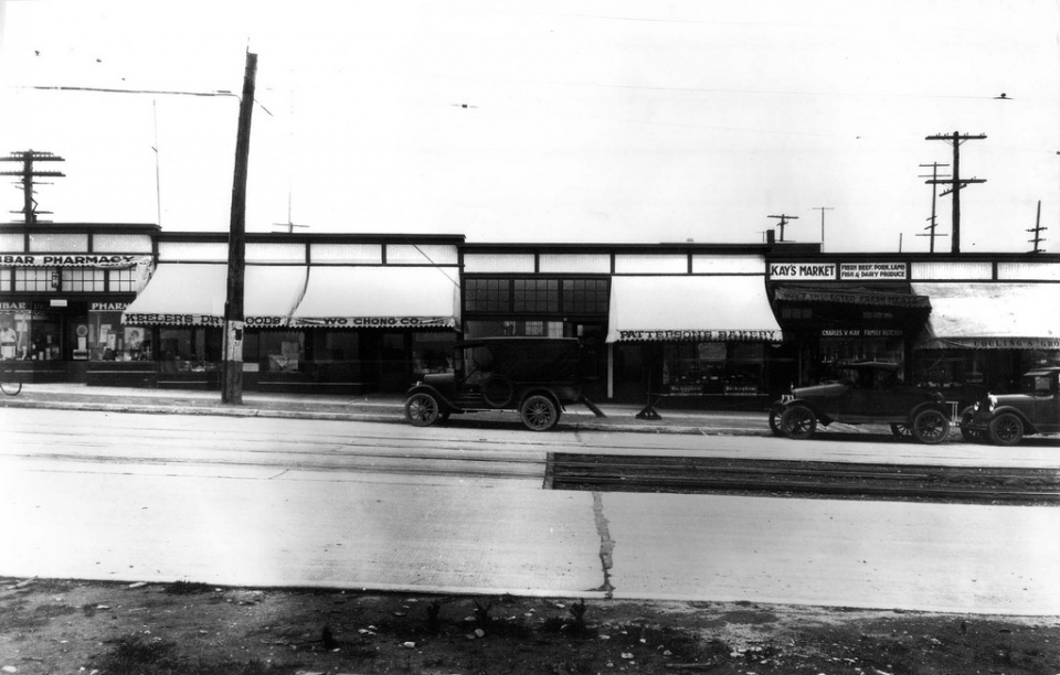
 West Side shops in Dunbar (1927)
West Vancouver police officers driving a Chevrolet along the 1900 block of Marine Drive. A small crowd of people
stand in front of a sign reading "Site of West Vancouver War Memorial Public Library".
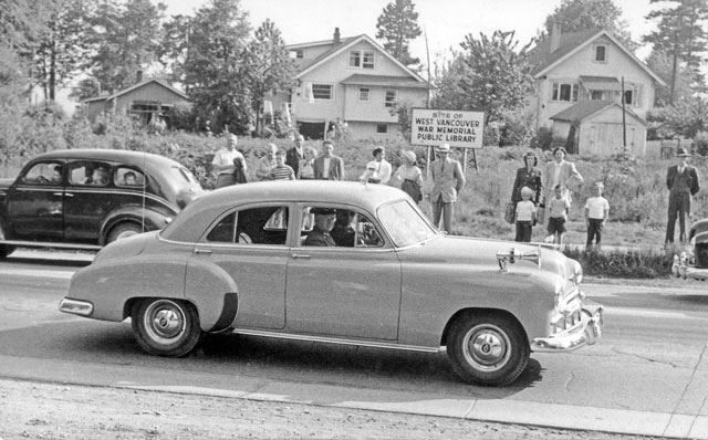 West Vancouver police officers driving a Chevrolet along the 1900 block of Marine Drive. A small crowd of people
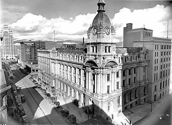
 The Vancouver City Hall a month before its opening (1936)
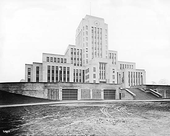 The Vancouver City Hall a month before its opening (1936)
Looking North across the Lions Gate Bridge (1939)
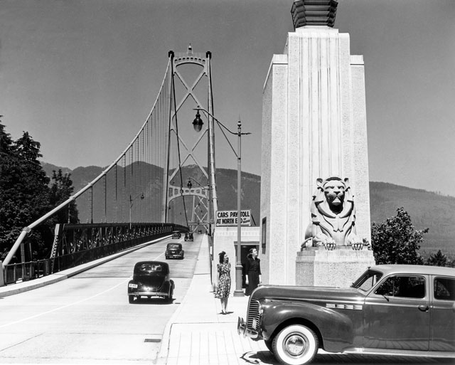 Looking North across the Lions Gate Bridge (1939)
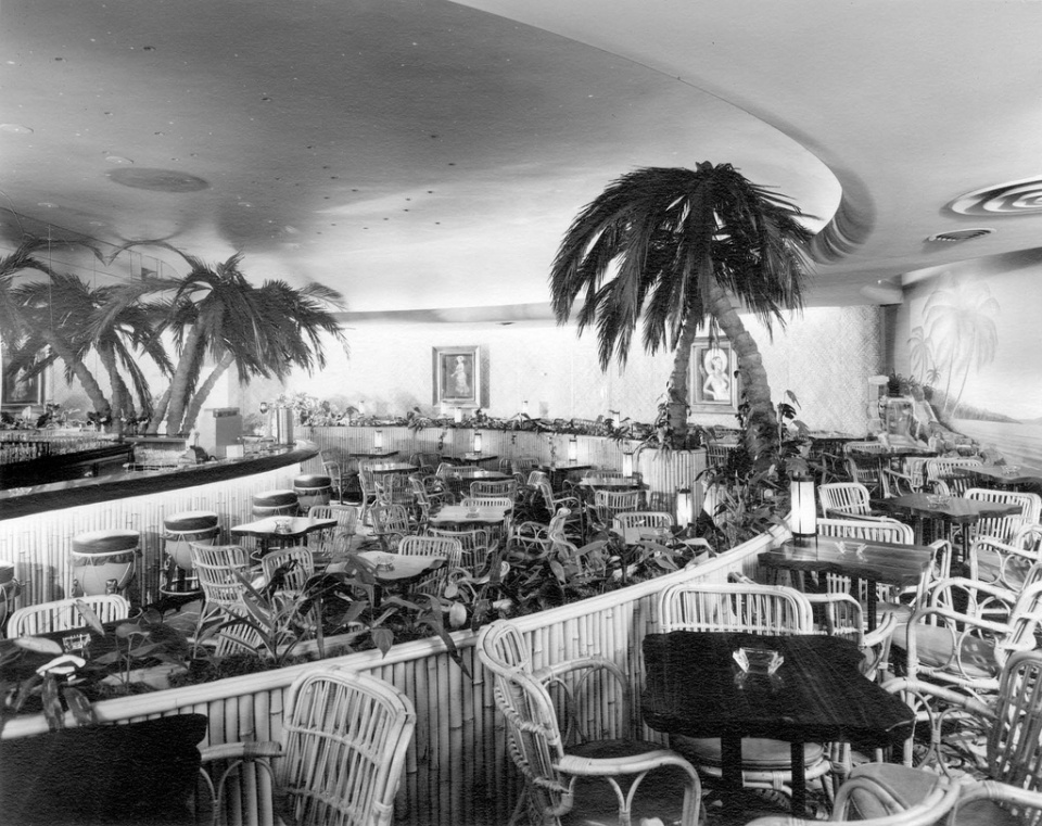
 Waldorf Hotel lounge / dining room (1955)
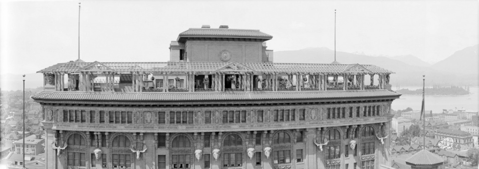
The view of Hotel Vancouver Roof Garden (1916)
Vancouver Post Office (1937)
 Vancouver Post Office (1937)
 Mount Pleasant Farmer's Market at Main Street in False Creek (1907)
Harpooned Moby Doll
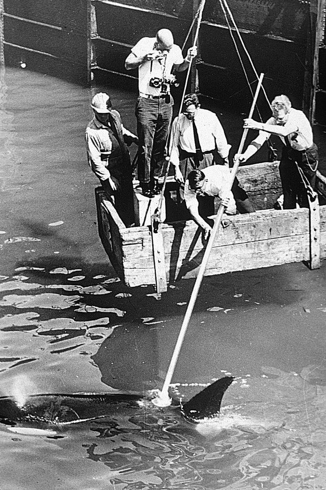
Moby Doll was the first killer whale in captivity, harpooned off Saturna Island in 1964. Once feared as dangerous man-eaters, now these animals are an iconic symbol of BC's coastal environment.
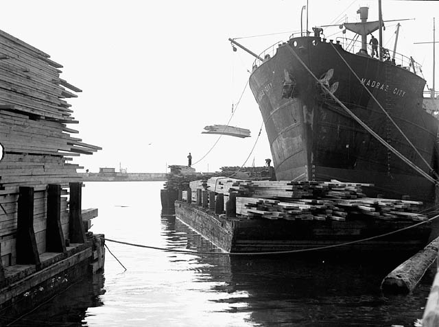 Log being loaded in Vancouver Docks (1940)
Half of these photos are NOT of Vancouver, but are of West Van and North Van, they may have the word ‘Vancouver’ in their names, but as any real Vancouverite knows(I am one)they are NOT Vancouver City!
Why not include Photos of Vancouver Washington too?
This confuses the history and identity of the City Of Vancouver(especially to anyone trying to do research into the City of Vancouver’s history!)
Hi Jim,
Thank you for your comment and correction, I agree that it’s confusing.
Cheers,
Jay
Seriously ?!? How is that confusing ?
I find all of the pictures very interesting. I counted 5 from West Vancouver which is to be expected since they came from the WV archives (half or 25%???) . My family moved to Vancouver in 1942 when I was less than a year old. As a “real Vancouverite” I thank you for making all of these pictures available.
What difference doe’s it make West Van/North Van/or Vancouver it is all history and I find it very interesting.